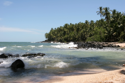
Coastal Landscape in the Amazon Rainforest


More than 90 percent of French Guiana is forested by the Amazon Rainforest. The image above on the left is the Coast of The French Guiana. The image on the right is the location of the Coast of French Guiana. The waves are formed by wave energy of the South Atlantic Ocean causing the shore above. Waves and tides transport sediments because of water pushing against rock formations.
Fluvial Landscape

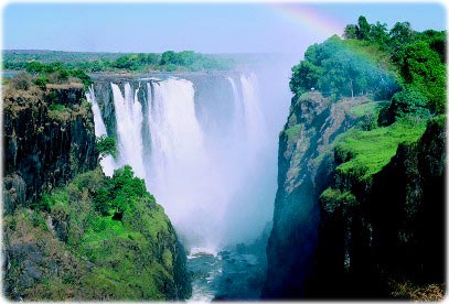
The Amazon River is the largest drainage basin in the world at about 7,050,000 square kilometers and accounts for one-fifth of the world’s total river flow. The river flows at an extremely high velocity creating numerous of cutbanks throughout the forest. At some points, the river gets cut off and creates oxbows. Because the valleys are shaped by water, V-shaped valleys from fluvial erosion are formed. However, when the streams try to reach equilibrium, knickpoints are formed. The most beautiful waterfall, Victoria Falls, has a huge knickpoint where it dumps the water into the Amazon River. When water flows into less resistant strata, it undercuts the area creating a knickpoint.
Biogeography

Biogeography includes human and physical determinants that influence animals and plants. The rainforest has more than half of the world’s biodiversity. Almost all rainforests are near the equator and they produce about 40% of the Earth’s oxygen. Deforestation has a major impact on the rainforest’s biome. It causes the extinction of plants and animals and changes the climate of the Earth. Swidden (slash-and-burn), the technique used in deforestation, which the ashes then fertilizes the soil to be used for farming.
Picture references: